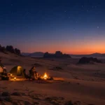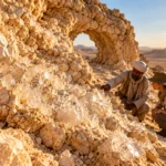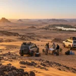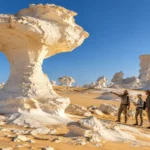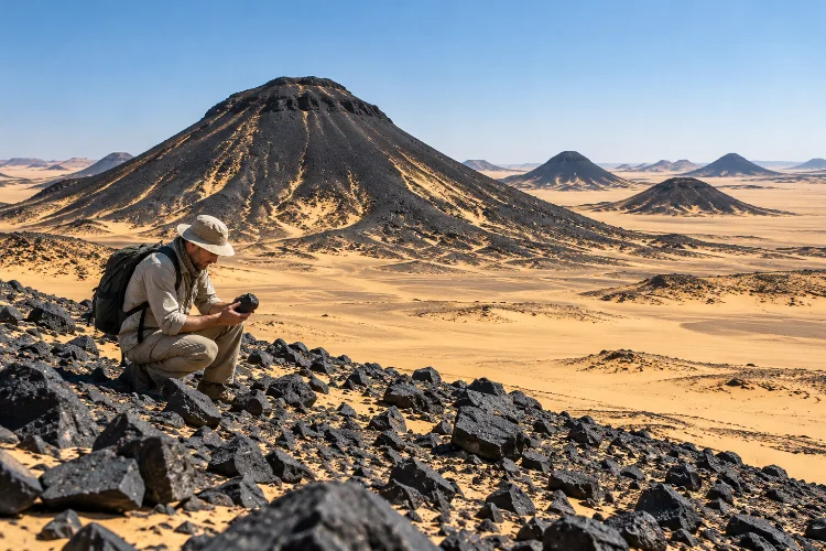
At first glance, Egypt’s Black Desert looks as though someone scattered volcanic cones across an enormous golden plain.
Dark hills rise from pale sand, black fragments cover slopes like charcoal, and the landscape seems completely different from the brilliant chalk formations of the nearby White Desert.
The geology is more complicated than the scenery initially suggests.
Discovering the geological formations of Egypt’s Black Desert reveals a landscape built from layers of sedimentary rock, ancient volcanic activity, iron-rich materials, weathering, and millions of years of erosion.
The Black Desert lies around the Bahariya Oasis in Egypt’s Western Desert. Bahariya itself is roughly 370 kilometres southwest of Cairo and contains an unusually diverse geological record ranging from Cretaceous sedimentary formations to younger igneous rocks.
Understanding those layers makes a visit much more rewarding. Those dark hills are not simply “black mountains” – they are visible clues to a complicated geological past.
Why Is Egypt’s Black Desert Actually Black?
The name comes from the dark material covering many of its hills and plains.
In parts of the Black Desert, sedimentary hills are capped or scattered with basalt and dolerite, while other surfaces contain iron-rich quartzite and ferruginous sandstone.
Egypt’s environmental authorities specifically note that some hills are dark because of dolerite and iron-rich quartzite, while reddish examples contain iron-rich sandstone.
This produces the dramatic contrast travelers notice immediately.
Golden and pale-brown sedimentary surfaces appear beneath blankets of dark rock fragments. Over time, weathering breaks these harder rocks into pieces that spread downslope, visually coating entire hills.
The result can make the terrain look volcanic from top to bottom even where much of the hill underneath is sedimentary.
That distinction is important because the Black Desert is not simply one enormous lava field.
Many of the Famous Hills Are Not True Volcanoes
The cone-shaped hills are one of the area’s most recognizable features.
From a distance, several look remarkably similar to small volcanic cones. It is easy to assume each one represents an extinct volcano, but the geology tells a subtler story.
Research on the geological heritage of Bahariya describes Black Desert hills composed largely of older Cenomanian sedimentary rocks that are topped by basaltic material.
In other words, their volcano-like appearance can partly result from erosion.
Harder caps protect portions of softer rock underneath. As surrounding sedimentary material erodes away, isolated hills remain standing. Loose dark fragments then spread across the slopes, strengthening the visual impression of a black volcanic cone.
A geolgical visit therefore becomes much more interesting when you start asking what is underneath the dark surface rather than judging each hill only by its shape.
Ancient Volcanism Did Transform Bahariya
Although not every cone-shaped hill is a volcano, genuine volcanic activity played an important role in the region.
Studies of Bahariya identify basaltic lava flows, volcanic necks, sills, and other intrusive or extrusive igneous bodies. Research on the regional volcanic field has dated significant activity to approximately 23.9–20.7 million years ago, around the Late Oligocene to Early Miocene transition.
The volcanic rocks include alkaline basalts and related compositions containing minerals such as olivine, clinopyroxene, and plagioclase.
One particularly interesting example is Mandisha basalt.
Geological heritage research describes basalt there occurring as a sill and preserving columnar and pillow-like structures. These exposures are valuable because they reveal how magma interacted with existing sedimentary layers.
So while the Black Desert should not be simplified into “a field of extinct volcanoes,” ancient magmatism is absolutely part of its story.
Older Sedimentary Rocks Form the Foundation
To understand the black rocks, you also need to understand what came before them.
The Bahariya region contains sedimentary formations extending back into the Cretaceous. The Bahariya Formation itself includes sandstone, mudstone, and related deposits formed during the Cenomanian, more than 90 million years ago.
Later sedimentary units added limestone, shale, marl, and other rock types.
Much younger volcanic material then cut through or spread over parts of these older formations. Research describes basalt and dolerite occurring as sills, dikes, and caps above sedimentary sequences.
This means a single Black Desert hill can effectively display two very different geological chapters.
Its lower part may record ancient sedimentary environments, while dark igneous rock on top records volcanic activity tens of millions of years later.
That contrast is one of the best reasons to explore the area with someone who understands regional geology.
Iron-Rich Rocks Add More Color Than Black
Calling the landscape the Black Desert makes it sound monochrome.
Spend time there and you quickly notice otherwise.
Some hills appear almost charcoal-black. Others contain rusty brown, red, orange, or purple surfaces caused partly by iron-bearing materials.
The Egyptian Environmental Affairs Agency notes that reddish hills may contain ferruginous sandstone, while darker formations can involve dolerite and iron-rich quartzite. A smaller number of hills expose pale limestone.
The Bahariya region is also historically important for iron deposits. Geological studies have identified major iron-ore localities within the wider oasis depression.
For visitors, this creates a useful practical exercise: stop thinking of the Black Desert as one color.
Look for transitions from black rubble to rusty sandstone and pale underlying layers. Those changes often reveal differences in rock composition and geological history.
Erosion Created the Landscape We See Today
Volcanic activity explains the presence of dark rock, but erosion explains much of the modern scenery.
Wind, temperature changes, gravity, and long-term weathering gradually dismantle exposed formations. Softer sedimentary layers tend to erode more easily than harder basaltic caps.
As the surrounding land is lowered, resistant sections remain as isolated hills or mesas.
Broken basalt and dolerite fragments accumulate along their slopes, creating what geologists call talus or rock debris. Wind then redistributes sand around these darker fragments.
This process continues today.
The famous hills are not frozen geological monuments. Their edges keep weathering, loose blocks keep moving downhill, and sand constantly shifts around their bases.
Observing erosion also explains why two nearby formations can look so different even if they share parts of the same geological history.
Compare the Black Desert With the White Desert
One of the best ways to understand the Black Desert is to visit the White Desert during the same Western Desert journey.
The contrast is dramatic.
The White Desert is famous for bright chalk formations produced from Upper Cretaceous marine sediments and later reshaped by weathering, wind, and karst-related processes.
The Black Desert emphasizes darker volcanic and iron-rich materials around the Bahariya region. Geological research treats both landscapes as significant components of the globally important geodiversity of Bahariya and Farafra.
Seeing them close together demonstrates how misleading the word “desert” can be.
A desert is defined primarily by aridity, not by one type of rock or landform.
Within one expedition you can move from dark igneous-capped hills to brilliant chalk sculptures, sandy plains, limestone plateaus, oasis vegetation, and fossil-bearing formations.
Few routes make geological diversity this visually obvious.
Look Beyond the Famous Hills Around Bahariya
The wider Bahariya Oasis deserves more attention than simply serving as the departure point for desert tours.
The region has been identified as containing at least ten major types of geological heritage, including igneous, sedimentary, paleontological, stratigraphic, mineralogical, geomorphological, and hydrogeological features.
Researchers have even argued that Bahariya and nearby Farafra have strong potential for geotourism because so many different geological features occur within a relatively compact area.
Bahariya is also famous for fossils.
Experience Egypt highlights Gabal Maghrafa because important dinosaur remains have been found in the area, adding paleontology to the region’s already complex geological story.
Other landscapes include springs, dunes, limestone exposures, basalt localities, and iron-bearing formations.
A geology-focused itinerary can therefore fill much more than a quick afternoon.
Explore With a Licensed Guide and Enough Time
The Black Desert is often visited as part of a 4×4 route from Bahariya toward the White Desert.
For casual sightseeing, a few hours may be enough. For geology, slow down.
Ask your guide to stop at different types of hills rather than only the most photogenic viewpoint. Walk short sections where permitted and compare loose fragments, sedimentary layers, dark caps, slope deposits, and erosion patterns.
Official Egyptian tourism guidance recommends arranging desert excursions with experienced licensed guides using suitable 4×4 vehicles. Travelers should also confirm permits, access conditions, and logistics before heading beyond the oasis.
Part of the Black Desert lies within the Bahariya Oasis Protected Area, declared in 2010. The protected area includes the Black Desert along with other sites of geological and ecological importance.
That protection is another reason to observe rather than collect.
Do not remove interesting basalt, fossils, or mineral specimens simply because they seem abundant.
Photograph the Geology, Not Just the Panorama
Wide photographs capture the Black Desert beautifully, but closer images often tell the geological story better.
Photograph the boundary between a dark cap and lighter sedimentary rock. Look for angular volcanic fragments resting on smooth sandy slopes or areas where iron staining changes rock color.
Morning and late-afternoon light are especially useful because shadows emphasize layering and surface texture.
A telephoto lens can also reveal formations on distant hills without encouraging visitors to leave approved routes.
If you keep notes, record which formations were photographed. A folder full of similar black hills can become surprisingly difficult to identify later.
This slower observational approach makes the enviroment feel less like a scenic stop and more like an outdoor geological field site.
Travel Responsibly Through the Protected Landscape
Dark rock may look indestructible, but desert environments can be surprisingly sensitive.
Repeated off-road driving creates tracks, while collecting rocks or fossils removes material from its scientific context. Climbing unstable formations can also accelerate erosion or cause injury.
Follow established or authorized vehicle routes and local instructions.
The Bahariya protected area was created partly because the region contains significant geological and paleontological resources alongside wildlife and other natural features.
Responsible geotourism should leave those features where they formed.
The most valuable souvenir is understanding why the landscape looks the way it does.
Discovering the geological formations of Egypt’s Black Desert reveals a landscape much more complex than a collection of dark volcanic hills.
Older Cretaceous sandstones and other sedimentary rocks form much of the foundation, while later basalt, dolerite, iron-rich materials, weathering, and erosion created the dramatic scenery visible today.
Some formations look like volcanoes without actually being simple volcanic cones, while genuine ancient igneous activity left lava flows, sills, dikes, and volcanic rocks across the Bahariya region.
Visit with an experienced guide, compare different hills closely, and combine the Black Desert with the nearby White Desert if time allows. Instead of simply photographing a strange black landscape, start reading its layers. The rocks tell a story stretching across tens of millions of years.